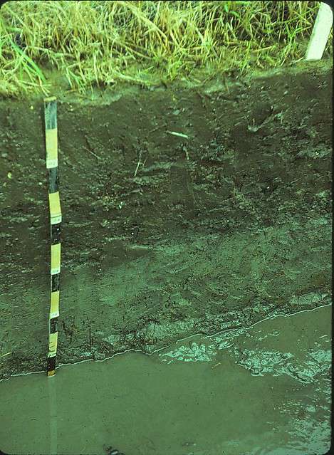
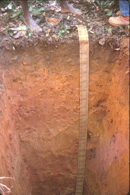
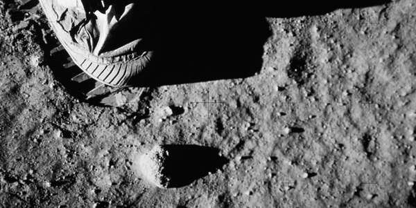
On the moon, even the dirt is deadly. Astronauts returning from the Apollo missions were quick to point out the long list of problems the Lunar regolith caused. In the absence of any atmosphere, the lunar surface has been bombarded by meteorites large and small for millennia, resulting in an extremely finely ground particulate material. The vacuum also exposes the soil directly to the solar wind and unfiltered UV rays, which supercharge the fine particulate with incredible static electric properties. Astronauts reported that the fine, abrasive particulate gummed up their spacesuit joints, wore through layers of kevlar on their boots, swirled around inside the lander and irritated their eyes, nostrils, and lungs, and could not be removed with wet wipes due to their static properties. Long before any construction or other usages can be attempted on the Moon, the dirt has to be taken into consideration. It may seem terrestrial in comparison, but the same is true of land use projects back on Earth.

3085355897_856439df1a_o.jpg

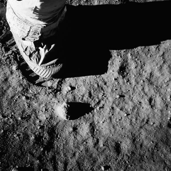
Constant meteoric bombardment due to lack of atmosphere is responsible for the Lunar regolith’s unique properties. Image Credit: Flickr User Marion Doss (CC BY 2.0)

READ  Can Spectral Analysis Be Used to Monitor Fluoride in Drinking Water?

Soil Surveys Are Essential to Land Use Management

Dirt matters. Soil surveys are an essential component of land use management, necessary for construction, agriculture, and conservation, as well as for archaeological and geological research. This need is driven by the drastic differences between soil types found across the globe, and over far more minute distances. Variations occur in texture, compaction, pH, elemental composition, relative amounts of organic material, and the ability to retain water, all of which can significantly impact the potential usages of the land. Soil scientists and engineers know that in order for project managers to choose the correct construction or agricultural techniques, they need to have an accurate diagnosis of their dirt.

Soil drainage is of particular concern. Poorly drained soil occurs as a result of a high water table, or when water from rainfall or nearby areas overloads a soil’s downwards drainage, lateral drainage, or evapotranspiration capacity. In order to accurately assess the drainage capabilities of a particular soil, which is important for planning appropriate residential, commercial, or industrial construction methods as well as potential crops, soil scientists and engineers conducting land use surveys turn to color as an indicator. As misidentifying the color of a soil may lead to improper usage, it’s important to get an as accurate reading as possible.

5140042455_134f602f62_z.jpg

This Philippine gley illustrates a poorly drained soil exhibiting a gray color due to lack of oxidation. Image Credit: Flickr User Soil Science (CC BY 2.0)

INFO  Get More Information

Assessment of Soil Color Determines Drainage Capabilities

Drainage affects the color of soil by its relationship to the oxidization of iron. Well-drained soils redden as their iron rusts; poorly drained soils appear more gray as water inhibits oxidation of iron. By assessing the relative redness of soil—after taking into account the soil’s age and the color of the parent material and any organic matter—the drainage potential of a soil can be accurately measured.

The current method of soil color assessment relies on human eyesight to match the color of soil samples with printed swatches, which varies on three axes: hue, value, and chroma. The scale accounts for all known terrestrial soil colors and provides a simple way for scientists and engineers to assess soil color in the field. However, according to the United State Department of Agriculture:

The visual impression of color from the standard color chips is accurate only under standard conditions of light intensity and quality. Color determination may be inaccurate early in the morning or late in the evening. When the sun is low in the sky or the atmosphere is smoky, the light reaching the sample and the light reflected is redder. Even though the same kind of light reaches the color standard and the sample, the 15 FSA Wetland Identification Procedures (Foundations to Sound Decision Making) reading of sample color at these times is commonly one or more intervals of hue redder than at midday. Colors also appear different in the subdued light of a cloudy day than in bright sunlight. The intensity of incidental light is especially critical when matching soil to chips of low chroma and low value.

Due to variations in illumination conditions and the subjectivity of human eyesight, false readings and misidentification can occur, potentially causing construction issues or poor crop yields.

8740923679_5f3d800ac6_z.jpg

As seen in this Eastern Madagascar excavation, soil color varies by depth, or horizon. Brown organic matter does not extend far downwards from the surface here. Image Credit: Flickr User Soil Science (CC BY 2.0)

Spectrophotometers Eliminate Inaccuracy in Munsell Identification

Misidentification can be eliminated by the use of portable spectrophotometric instruments, such as HunterLab’s MiniScanEZ 4500L 7. These sensors assess color on the same three axes as the Munsell scale, and unlike the human eye, report the same results every time. They also mitigate inaccuracies caused by differences in illumination by their use of standard illumination settings. The instrument measures color based on reflected light; it’s a simple matter to use the same level of light for each measurement. This model uses 45/0 optics to deliver an accurate reading whether measuring sand, silt, or clay.  Its portable nature and durable construction are designed for use in the field, and can stand up to conditions at least as tough as its operator can. The MiniScanEz 4500L can store 750 readings in its onboard flash memory which can be exported in Excel format to a USB Memory stick or directly to a computer running EasyMatchQC software for further or more indepth analysis.   To learn more about how spectrophotometric assessment can improve your soil surveys, contact the experts at HunterLabs.